Randonnée Marche Les Vans - Bois de Païolive - Photo
 Bobol
Bobol

Utilisateur

© OpenStreetMap contributors
Longueur
Longueur
2,9 km
Altitude max
Altitude max
226 m
Dénivelé positif
Dénivelé positif
31 m
Km-Effort
Km-Effort  
3,3 km
Altitude min
Altitude min
206 m
Dénivelé négatif
Dénivelé négatif
29 m
Boucle
Boucle
Oui
Date de création :
2014-12-26 00:00:00.0
Dernière modification :
2014-12-26 00:00:00.0

(1 Avis)

Marche
Marche
1h33
Difficulté : Moyen

Scannez ce code QR pour ouvrir la randonnée dans l'application SityTrail

Application GPS de randonnée GRATUITE

Logo SityTrail SityTrail

IGN / Instituts géographiques

Télécharger SityTrail sur l'App Store Télécharger SityTrail sur Google Play

Logo SityTrail SityTrail World

Le monde est à vous

Télécharger SityTrail sur l'App Store Télécharger SityTrail sur Google Play Télécharger SityTrail sur Huawei AppGallery

À propos

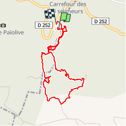
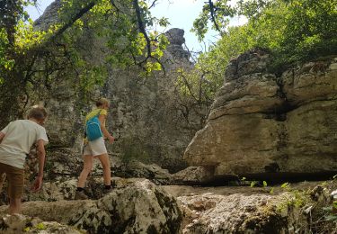
Randonnée Marche de 2,9 km à découvrir à Auvergne-Rhône-Alpes, Ardèche, Les Vans. Cette randonnée est proposée par Bobol.

Description

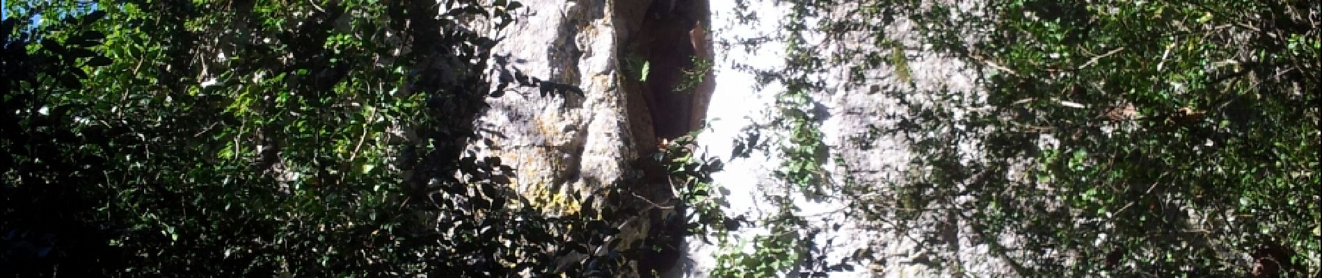
Bâtons conseillés, le chemin est caillouteux.

Profil altimétrique

Photos

Localisation

Pays :
France
Région :
Auvergne-Rhône-Alpes
Département/Province :
Ardèche
Commune :
Les Vans
Localité :
Chassagnes
Départ:(Dec)
Départ:(UTM)
593831 ; 4916381 (31T) N.

Commentaires

Veuillez vous connecter pour laisser un commentaire ou une note


Randonnées à proximité

Randonnée Marche Banne - Autour de Banne  - Photo
Marche
GUIDE
nadinebondoux

Marche

Difficile
Banne, Auvergne-Rhône-Alpes, Ardèche, France
19,8 km | 28 km-effort
5h 46min
Oui
Randonnée V.T.T. Les Vans - Vans banne Berrias retour - Photo
V.T.T.
WALCH

V.T.T.

Moyen
(1)
Les Vans, Auvergne-Rhône-Alpes, Ardèche, France
23 km | 28 km-effort
2h 10min
Non
Randonnée Marche Les Vans - GRP Le Cévenol Brahic-Génolhac 32km  - Photo
Marche
GUIDE
thonyc

Marche

Difficile
Les Vans, Auvergne-Rhône-Alpes, Ardèche, France
32 km | 50 km-effort
11h 28min
Non
Randonnée Marche Berrias-et-Casteljau - Wikiloc Bois de Paiolive (PVDB) - Photo
Marche
GUIDE
Peter.vdbergh

Marche

Moyen
Berrias-et-Casteljau, Auvergne-Rhône-Alpes, Ardèche, France
9,9 km | 12,3 km-effort
4h 24min
Oui
Randonnée Marche Berrias-et-Casteljau - paiolive - Photo
Marche
gvanpouille

Marche

Très facile
(1)
Berrias-et-Casteljau, Auvergne-Rhône-Alpes, Ardèche, France
5,6 km | 6,7 km-effort
2h 16min
Oui
Randonnée V.T.T. Berrias-et-Casteljau - Berias et environ - Photo
V.T.T.
gvanpouille

V.T.T.

Difficile
(1)
Berrias-et-Casteljau, Auvergne-Rhône-Alpes, Ardèche, France
23 km | 27 km-effort
1h 41min
Oui
Randonnée Marche Banne - 07_Banne_8km290m - Photo
Marche
SyMA

Marche

Facile
Banne, Auvergne-Rhône-Alpes, Ardèche, France
8 km | 11,9 km-effort
2h 36min
Oui
Randonnée Marche Chandolas - Maisoneuve-Ron-Redon-Chandolas.8km+101m - Photo
Marche
ganinette

Marche

Moyen
Chandolas, Auvergne-Rhône-Alpes, Ardèche, France
8 km | 9,4 km-effort
2h 7min
Oui
Randonnée Marche Les Assions -  Chapelle Ste.Appolonie.6.5km+260m.2024 - Photo
Marche
ganinette

Marche

Moyen
Les Assions, Auvergne-Rhône-Alpes, Ardèche, France
6,5 km | 9,4 km-effort
2h 8min
Oui


Fermer
Mes abonnements